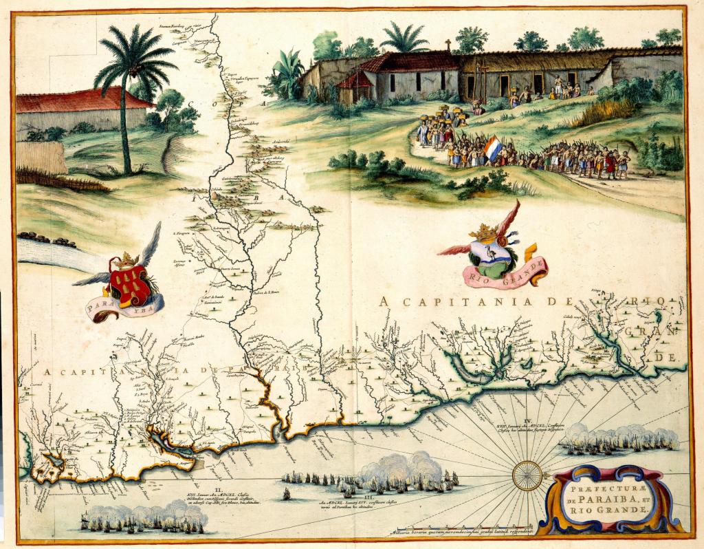
This image was published in Joan Blaeu’s Atlas Maior and previously appeared in Caspar Barlaeus’s Rerum per octennium in Brasalia (1647). Much like other maps appearing in these texts, the Map of Paraiba and Rio Grande blends cartographic forms and figurative scenes depicting life in Brazil under Dutch governorship. At top right appears a procession of Brazilian Indians leaving the church with one even holding the Dutch flag. The coats of arms of the governors of Paraiba and Rio Grande similarly act as an adornment for the map and underscore the colonial political message of the engraving.
Image source: http://www.atlasofmutualheritage.nl/en/Map-Paraiba-Rio-Grande.7743
