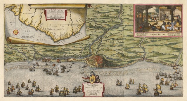
Map of Pernambuco by Claes Jansz Visscher (c. 1640) Claes Jansz Visscher, Rare broadside map celebrating the Dutch capture of the town of Olinda in Pernambuco by the Dutch West Indies Company in February 1630, c. 1640, etching Image source: https://commons.wikimedia.org/wiki/File:Nicolaes_Visscher_-_Pharnambuci_(Pernambuco,_Brazil).jpg Share this: Share on X (Opens in new window) X Share on Facebook (Opens in new window) Facebook Like Loading... Related

.jpg)